Welcome!


Monticello Road is a community arts project in Charlottesville, Virginia. Through photography and a series of public events and conversations, we explore how an art can be an essential, integral and everyday part of a healthy community.


About | Summary | Events | Media | Backers | Contact/Sign Up | Donate


Friday, August 30, 2019

The Flow is about to Flip


Westbound traffic on Monticello Road will be routed to the left onto Levy. Eastbound traffic coming from Graves and the Bridge PAI will need to make this hairpin turn on to Levy. My solution would allow them to continue to Rialto or some easier turns than this.

The pilot project to reverse the direction of the westernmost block of Monticello Road starts Sat. October 5 with a 1-hour trial. If that doesn’t cause too much pandemonium, there will be a longer [short-term] trial. I will be interested to see how it goes.

Logistical details and the rationale here.

This is happening because the new Belmont Bridge design will not permit left turns out of Graves Street onto 7th Street/Avon at Quality Pie. Without this change, all else remaining the same, residents and visitors will need to either drive under the bridge (private road, which will be closed during portions of construction) or via a winding half-mile detour to Goodman.

In this trial, outbound traffic from Graves will drive contraflow on Monticello, right on Levy and exit at the traffic light. Eastbound traffic on Monticello Road will be routed onto Levy and also exit at the light. Levy is extraordinarily wide and is expected to handle the cars waiting at the light.

I reported on the plan in detail last year and I analyzed the issue in a bit more detail than I will here.

As did Elliot Robinson

I did not agree with the decision to eliminate the left turn out of Graves—it seemed like a solution without a problem. If we accept that decision as a done deal (and I think it is) then something needs to change and this could be workable solution, worth a try. Not everyone agrees with it, but there was also opposition to the Downtown Belmont sidewalk enhancements, which have been a big success. Engineering brief | Oral History

My preference would be for the one-way portion of Monticello Road to be reconfigured as a yield-street where all users share a narrow road in both directions and occasionally need to move over and wait a moment to let each other pass. It may seem strange but this type of street is among the safest for all users because it forces people to drive slowly (As they always should on a residential street). They exist all over the world, including, it must be noted, the rest of Monticello Road, which operates in that manner (in practice if not in theory).

This western portion of the road is slightly narrower than the rest of the historic and naturally speed-controlled byway butw what really makes this stretch different is the preponderance of parking. Let's be real though: most spaces are used by commuters seeking free spots, restaurant-goers, and employees. Some of this would need to be eliminated but it would be interesting to do a full count and measurement to see whether the concept could work if only residents are accommodated. I’ll do that soon if I get a chance. Email me if you would be interested in helping with this project.

In answer to a question I receive frequently, the question of bicycle facilities on the new configuration will settled after the trial and the road gets repainted (hopefully including contraflow lanes or signage permitting contraflow riding) after the configuration is finalized (or undone).

In the meantime, I support the idea of the pilot as a low-cost, low-commitment way to try something new. If it doesn’t work, no harm done and we switch it back. But we should encourage traffic engineers to try new things. Monticello Road is one of the oldest and most interesting streets in the region. A big part of that is because its quirks force people to acknowledge and accommodate one another. And the mix of preservation and experimentation is what makes Belmont fun.

Tuesday, January 1, 2019

Taking a Personal Celebration Up a Notch


Running has always been a passion of mine, but it is also one of the main ways I stay mentally (as well as physically) healthy. I lost that outlet for a while last winter due to injury and it took me many months to regain what I had lost. Happily, by summer I was back fully fit—and even better because my rehab had improved my strength, balance, and flexibility. I’m grateful for the process and I wanted to celebrate my return to wellness in a way that adds abundance to the community that helped me get back on my feet.

Charlottesville is blessed with many beautiful (but often hidden or even private) places to experience nature. Perhaps the crown jewel is the Rivanna Trail, a twenty-mile hiking path that encircles the city. It is a favorite spot for running, walking and mountain biking and I have probably logged thousands of miles on it—but I’ve never done the whole thing at once. There is a group that runs the loop every year around the winter solstice so I made that my goal: I trained and prepared for the 20-mile loop run in December as my own celebration of good health.

From my 20-years’ work on the New York City Marathon I knew that running—that seemingly solitary sport can—can also be a massively collective celebration of the Possible. I wanted my personal milestone to happen in a way that could inspire other people, draw strength from those around me, and have a direct positive financial impact: all things that happen abundantly with the five-borough race. I decided to do the run as a fundraiser for my employer, the Piedmont Environmental Council, which among other things promotes trails in my area.

This decision to run for a cause had consequences. It made it larger than me and created accountability. Once I announced publicly that I would do it, there was no going back. It also rallied lots of support to my side in the form of encouragement from family, friends, and even a group of my teammates who volunteered to run all or part of it with me. That group of champions happened to include the physician who oversaw my rehab, which was a nice connection.


The run got delayed by a week due to epic flooding on the trail, which was actually kind of good because it landed the run on the day after the Solstice. It was a bit of a sogfest: we still had to wade through waist-deep water in several places. It was also more beautiful than I had imagined, with a mist, clear light and a big full moon that set at sunrise of that first lengthening day. Although I was obviously tired at the end and it was plenty challenging, it was easier on my body than I had expected. That might result from the joy of celebration: it felt more like renewal than closure.

I easily exceeded the modest ($400) goal I had set. I could have probably raised much more but that wasn’t really the point. I mainly wanted to demonstrate that the ways that we each personally strive to become better at whatever we do can be shared with others. It will inspire them; and when they rally to your cause, it will further energize you and make your goals easier to obtain.

I’m telling you this in the hope that it will inspire you. As you make plans and do your cool and even wacky projects, be sure to let other people know about them so they can help you and get better together. It’s good for everyone.

Friday, August 17, 2018

Flipping the Flow


There is a proposal to flip the direction of westernmost block of Monticello Road (currently west-bound) because of some restrictions stemming from the Belmont Bridge replacement.

Charlottesville Traffic Engineer Brennen Duncan has proposed an interesting change to Monticello Road. He suggests flipping the direction of its westernmost block as a short pilot (one day). If that goes smotthly, he will try it for longer (six months) prior to making a permanent proposal. I actually like the fact the he is trying new things and this is a spirit of problem-solving that the City really needs, so I support it. The change also could allow some significant bicycle improvements. I wish he didn’t have to seek this solution because, in my view, the cause is unnecessary.

As part of the Belmont Bridge replacement plan, left turns will no longer be permitted from Monticello Road (technically Graves) onto 9th Street (the Belmont Bridge). This will make life extremely inconvenient for anyone who lives or works at that end of the neighborhood, as all current substitute routes are quite circuitous and include stretches even more problematic than the original turning movement.


These are the two route options for someone wishing to head south on Avon from the corner of Monticello and Graves. I think the technical word for a re-route of this kind is "silly."(Base map: City of Charlottesville)

Support for this change was tepid to negative (see note). Still, the engineering firm insisted (due to projected traffic flow improvements) and got the element included in a final design concept approved in a late-night City Council vote. I'm tired of fighting about the Belmont Bridge and ready to move on.

To solve the problem before us, Brennen proposes flipping the direction of the final block of Monticello (currently westbound only) so motorists will be able to exit via Levy Street, which has a traffic light. All traffic flowing westbound on Monticello will bear left and exit at Levy, as well. The eastbound movement includes a hairpin turn; so to create the necessary turn radius, they will need also need to move parking from the current north side to the south side.


This solution is not perfect but it is rather genius in its simplicity.

We also hope to use the occasion of repainting to add a badly-needed contraflow bike lane so cyclists will be able to travel both directions on Monticello Road, which is the safest and easiest connection from downtown to points southeast.

There are community concerns, which Brennen lays out in his memo, but his contention is that we will never really know until we try it. I see no harm in giving it a shot: in a City that is often very risk-averse, I salute his spirit in trying something new. He’s proposing to do it in a very low-stakes way and if it works, maybe the City will be encouraged to try other new things.

I’m disappointed that the Bridge design team created this problem—they didn’t need to and it undercut some good community engagement they had done earlier. But I’m ready to move on and if we truly are stuck with it, then I think we should try Brennen’s creative approach to dealing with the consequences. We should support City staff trying new things in a thoughtful, do-no-harm way. If we don’t like it, we can change it back and if we do like it we will have something no one else would have thought of.

City Council will hear Brennen's report at the end of its August 20 meeting. The meeting starts at 6:30 and you may make comments then. Brennen's report will be much later (probably after 9:30) and you may also comment at the end. His report can be found here (page 141).

Note: Design firm Kinley Horn did not put the left turn out of Graves into public discussion--the alternatives they offered assumed this change. My memory is that the community opposed this and the documentary evidence support this. See voting sheets and presentation in which all options assume this closure. Feel free to point me to evidence of public support (besides their own notes) and I will stand corrected. Their resource page is here.

Monday, June 25, 2018

An Equity + Development Field Trip


When I asked the youth which part of the trip they liked best, they all said the same thing: "The Museum." I could not disagree.


Last week, I had the good fortune to tag along with the Youth Leadership Team from Friendship Court, as well as some friends and mentors, on a trip to Washington, DC. The purpose of the visit was for the seven high school students to learn more about Equity Planning, property development and how the two intersect, through the lens of some specific projects. It was the culmination of a two-year program of civic education to empower them to be active contributors to Friendship Court’s redevelopment plan.

After taking the morning train and depositing our luggage at a rented townhouse, we traveled to Southeast to meet with Vaughn Perry, Equitable Development Manager of the 11th Street Bridge Park. The 11th Street Bridge project is one that I have been following closely because it is cool in so many ways. Attempting to bridge the Anacostia's social divide is challenging enough but they are also setting a new standard of positive social impact.

The project is relentlessly community-driven. It started with an honest discussion of whether the neighbors even want the park, and if so what kinds of features, uses, and programs will make the project appealing and useful for the entire community—especially those under-served neighborhoods on its south bank. This striking architectural project is accompanied by an equally bold Equitable Development Plan, which has specific strategies for workforce development, affordable housing, and small business enterprise. Although it's by no means required (or anything like standard practice), they’re on track for a 1:1 match of community development monies raised to park project funding.

Tyquan asked what was on everyone’s mind: “Are you really going to build this?” Vaughn didn’t hesitate, “We’d better build it—too much is at stake not to. Let me just say this: I’m 99.9% certain.”

From a physical standpoint, it’s still just a plan, although work is slated to begin in a year or so (a speed made possible by the fact that it is being built with local, not Federal, funds.) Still, they are not waiting for the physical structure to start pulling people to the river or to pursue their equity mission. They co-host a major festival in adjoining Anacostia Park, as well as youth programs (focused on gardening and the river), neighborhood-specific public art, a Ward-8 home buyers club and more.

They host periodic walking tours and I think we should take a group from Charlottesville. In any case, this is definitely a project I will continue to watch.

The meeting with Vaughn was a big highlight for me, but it was just the beginning of an ambitious agenda. The youth also met with Matthew Steenhoek, vice-president of the firm that is developing the massive mixed-use District Warf project. They had a private visit (!!!) to the National Museum of African American History and Culture. And, they toured SeVerna on K with Mel Thompson, of Grimm and Parker—the firm selected to redesign Friendship Court. SeVerna is very similar to the envisioned future of Friendship Court and it was very enlightening to walk through an actual space (including some apartments)--much better than looking at plans or drawings. I think it would be useful for more people to do that.

It was a whirlwind trip, with a lot to take in and no small amount of walking and riding around the capital city. It was great to hang out with the kids, most of whom I’ve known since they were very young. It was also quality time with some of my favorite adults—Barbara Brown-Wilson, Claudette Grant, Beth Meyer and Margaret Haltom. It’s nice to be with friends but it’s especially great to be together in beautiful spaces and to see real-world expressions of ideas we talk about so much.

I'm looking forward to applying some of what I learned to my work in Charlottesville.

Saturday, June 23, 2018

Catching Up


Monticello is one of several connections we are trying to create between Charlottesville and surrounding assets in Albemarle County. Here, the an existing social trail to the future Biscuit Run Park that should be made safe and legal.

I was horrified to look at my blog and discover nothing since 2017! It's not like I haven't been writing; simply the Monticello Connectivity Project is being included in a larger and very ambitious regional connectivity project I'm working on now. I'm writing ALOT on that project's web site.

Here are some highlights:

Packed Room for Greenways Kickoff Event (October, 2017)
Cypherways Uses Hip-Hop to Generate Ideas and Enthusiasm for Greenways (November, 2017)
About the Greenways Project (January, 2018)
Fifth Street Hub: A Project with Momentum (March, 2018)
Photo Gallery: Anacostia River Greenway (April, 2018)
Photo Gallery: High Bridge Trail State Park (May, 2018)
Charlottesville / Albemarle Bike / Ped Survey (June, 2018)

I am working on a few things specific to Monticello and Beyond. More on those soon...

Wednesday, October 18, 2017

Mobility and Mobilization


Like the Practicum project, this new venture will connect kids, families and communities to resources and opportunities.

I have started a new job with Piedmont Environmental Council. In cooperation with the Thomas Jefferson Planning District Commission and with support from the Charlottesville Area Community Foundation, we are working with communities in both Charlottesville and the urban areas of Albemarle County to envision and implement a connective network of trails and greenways. In many ways, it is an enlargement of the Monticello Connectivity practicum project.

The project has two main intertwined elements. We will talk to many people in diverse organizations and neighborhoods to develop a multi-modal transportation plan that truly reflects community ideas, needs and values. We will also engage with stakeholders to develop the civic infrastructure to keep sustain public advocacy to bring that vision to reality both by holding government accountable and by contributing their passion and even labor as well as their ideas. It’s about both mobility and mobilization.

We will begin our two-year project with a kickoff event on Wednesday, November 8 6-8 p.m. at the Jefferson School African American Heritage Center. Greenways guru Chuck Flink and Max Hepp-Buchannan from Bike-Walk RVA will share insights about the benefits of greenways and ideas about how to make them happen.

We will follow that with a series of events, community visits and conversations about how to make a more connected community.

Kickoff Event | Project Page

Wednesday, September 20, 2017

Case Study: Virginia Creeper Trail


One of 47 bridges and trestles on the Creeper Trail.

The Monticello Connectivity Practicum team studied a number of regional trail projects to find out what works and what we can learn from them. This past weekend, I was able to visit one of the best of them and experience it first-hand. After reading hundreds of reports and gushing reviews I had high expectations for the Virginia Creeper Trail. It exceeded them.

The Creeper follows an old railroad right-of-way through the mountains and valleys of Southwest Virginia. Meredith and I rented bikes for the day and one-way shuttle service in Abingdon ($26 each) and rode the full 37 mostly-downhill miles back from White Top. It felt epic but attainable for someone who is active but not a cycling specialist. Shorter routes are available. The entire first half is a very easy ride and barely requires pedaling. As a result, we saw all body types, kids and seniors. The beauty is breath-taking and I was thrilled to see so many people out enjoying it. Because most people ride the same direction, there was little conflict even on a peak-usage Saturday afternoon.

The right-of-way is a three-way partnership between the United States Forest Service, the Town of Damascus and the City of Abingdon. Much of the trail is on Forest Service land, but more than half of it is on private land, passing alongside (and through) villages, farms and woodlands. Trespass is not an issue: the trail design keeps you on it and there’s really no reason to leave except to patronize the businesses it passes.

Thursday, August 17, 2017

Locating Monticello Road


1937 aerial photo of Charlottesville's southeast corner, transposed on the contemporary landscape, with the intact portion of Monticello Road highlighted in blue and its lost portion red. (Photo: City of Charlottesville).

Chris Gensic sent me a set of aerial photos that give us the best idea yet of Monticello Road's historic route, and specifically the course of  the section that is buried under Interstate 64. This 1937 photo predates the construction of Monticello Avenue (the route of which appears on earlier plats)--and it definitely predates I-64. It's interesting that at the time, Monticello and Scottsville Roads were united within the City limits and only diverged after crossing Moore's Creek--that's why it makes a hard left turn.

We were wondering the road's exact relationship to the creek: where it crossed, which bank it followed and precisely where it turned cross-contour. We want to understand that so we can make the most historically authentic connector trail. I georeferenced Chris's photo, then made a shapefile of the old road's course and added it to my database.


The former course of Monticello Road (red) and some nearby trails, including the connective corridor the Practicum Team studied (purple).

A future trail will not necessarily follow the precise route. Practicalities about crossing the creek and interstate, finding gentle slopes and keeping pedestrians separate from cars will all influence the trail's siting. However, of the four corridors the Practicum Team considered, this one is the truest spatial expression of the City's connection to the Heritage Site. Accurately locating the original road course (at least its early 20th Century incarnation) will help trail planners weave a more multi-faceted trail experience.

Tuesday, August 1, 2017

Beyond Monticello: Morven

After presenting the Monticello Connectivity report, people asked what I was planning to do next. My answer was often, “Hopefully something like this.” That wish received a nice down-payment when the UVa Foundation’s Morven hired me to work with their staff and two Architecture School interns to study the feasibility of trails at (or to) Morven. Morven borders James Monroe’s Highland and is about two miles from Monticello. There is growing interest in a trail connecting the historic sites, which would vastly extend the connected network we are already developing.


Students from the Morven Summer Institute hike on one of Morven's many undocumented--but beautiful--trails.

Morven is a 2,913-acre farm bequeathed to the University of Virginia in 2001. Besides hosting a full calendar of events throughout the year, Morven is the site of a Summer sustainability Institute, a Leadership Forum for future African leaders, a forthcoming women’s initiative and the University’s Kitchen Garden. Along with Monticello, Highland, Montpelier, the University of Virginia, the College of William and Mary, Morven is part of the Presidential Precinct. That alliance is mostly programmatic but I’ve long wondered if its alliance could be spatial too, which would open a vast (approx. 6,000 local acre) domain of connected discovery right on Charlottesville’s border.

Morven is less well known than some of its neighbors, but it is equally beautiful and historically fascinating. As part of his effort to gather his friends as neighbors, Thomas Jefferson facilitated the sale of a property known as “Indian Camp” to his friend William Short in 1796. They planned to divide the property into 100-acre tenant farms as an experiment in free yeoman agriculture that Jefferson so often extolled but did not himself practice.

Obviously, that model did not sweep the American South, but it’s a fascinating story with profound implications and many other histories are layered above and below it. Combine them with an incredible landscape and UVa’s forward-looking sustainability program and Morven becomes a multi-layered cultural landscape well worth exploring.

Monday, July 10, 2017

What's Next for the Monticello Connectivity Project?


This diagram combines the theory-of-change logic model I designed last year with VDoT's excellent Community Trail Development Guide and is part of the Practicum report's conclusion. Right now, we are in the yellow portion of the process.

The Charlottesville to Monticello Connectivity Study was well-received by many people we respect, including stakeholders in government, non-profits, academia and—best all—the community. We didn’t start this venture but I think we helped move it forward.

The next step is for the stakeholders to prioritize issues we developed and get to work on them and there has already been some progress on that front. A subset of our advisory group got together a few weeks ago and looked at priorities. Here’s some of what they came up with:


Our plan recommends building a full network of connections, but some segments are easier or more important, so we suggest a phased approach. (Map layout by Monticello Practicum Team) [Details about all routes]

Thursday, June 22, 2017

Connective Corridors to Monticello

Charlottesville to Monticello & Beyond is a report I co-authored about re-connecting Charlottesville to Monticello for pedestrians and cyclists. The entry explores the core of the report: a comparison of four possible connective corridors. My deepest gratitude to my co-authors (Maura Harris, Caroline Herre, Joel Lehman, and Julie Murphy) whose ideas and language infuse this entry.


The practicum team and its advisors studied four corridors to connect Charlottesville to the Saunders-Monticello Trail based on City and County Comprehensive Plans, which are closely aligned on this subject. Although it is possible to get from source to destination using other routes, such as stream valleys, our analysis had to be finite and build upon our stakeholders’ previous consensus-building work. Our work focuses mainly on transportation corridors, while acknowledging that a truly comprehensive outcome will probably make other, more recreational connections, too.

For convenience, we named these corridors Routes A, B, C, and D.

Tuesday, May 30, 2017

Saunders-Monticello Trail User Thoughts on Connectivity

The following two entries dive deep into the recent report I co-authored on connecting Charlottesville to Monticello & beyond.

A large part of our research centered around the fabulously-successful Saunders Monticello Trail, which serves as a gateway to Monticello and will the linchpin of our connector(s). We conducted a survey of current trail users because it is essential that we understand their preferences and desires if our own project is to be successful. The survey succeeded far beyond our expectations, with 1010 responses in 18 days.


The chart tallies a manual count of concept mentions relative to connectivity. We also did a word cloud cloud (see end of article) but we found the manual method much more informative and precise. A word cloud, for example, does not distinguish between a user who says "I want a connection," and one who says, "I don't want a connection." Word clouds give a useful glimpse but are not sound basis for policy.

Out of the 1,010 survey responses, there were 443 comments in response to the open-ended question “Do you have any other comments about connecting the trail to Charlottesville and/or other destinations (e.g. Morven Farm, Highland, Mill Creek, PVCC)?” The chart left illustrates the relative themes that emerged. All topics with two or greater mentions are included.

Endorsements
Among the responses, the most mentioned by far was a positive response expressing support and excitement for the trail.

Destinations
Respondents mentioned Piedmont Virginia Community College more than any other destination, but quickly followed by many of the major destinations explored in the study: Morven Farm, the Rivanna Trail, James Monroe’s Highland, Route 20, Belmont and the Charlottesville downtown area, and Avon extended and its associated neighborhoods (including Mill Creek). Several other respondents considered the broader regional connection possibilities, including the 3 Notch’d Trail, Scottsville, and Crozet.

Bikes and Accessibility
A significant number of respondents mentioned desire for bike access through the connection. Some respondents hoped for facilities if the trail is expanded and connected into a wider network, particularly parking. Regarding accessibility, several respondents mentioned a desire to continue bringing their family to the trail, others mentioned a desire to bring dogs, to connect the trail to transit, and for the trail to be ADA accessible and friendly for senior users. Of particular note about the transit access, several respondents mentioned a desire for a shuttle bus that would connect the end of the trail to key destinations within Charlottesville, including PVCC, UVA, and the Downtown Mall.

Trail Characteristics and Amenities
Several respondents mentioned a desire to highlight and maximize historic and cultural connections through the trail network expansion. Some respondents mentioned key physical aspects of the trail, including a preference for a pathway that is not directly adjacent to the street, and a desire to increase crosswalk safety.

A few respondents reacted negatively to the premise of the study: either they did not desire a trail, did not desire a trail to connect to their neighborhood, or did not desire bikes to be allowed to use the trail. Two respondents expressed concern and recommended thoughtful consideration about the people who have set up camps beneath and near the I-64 and Route 20 bridges.

Friday, April 28, 2017

Why Visitors Love the Saunders Monticello Trail


saunders_thoughts.jpg

Out of the 1010 survey responses, there were 681 comments of various length. We divided the terms into categories, among which a few key themes emerged. They are summarized, in chart form, above. Here's what they tell us:

Design and Upkeep
The gentle, sloping boardwalks are wildly popular. Users like that they moderate the challenge of climbing a mountain and make the trails accessible to people of all abilities. They like that they’re wide enough to be social, that there are also more rugged options, there is educational signage along the way and they are long enough to merit a trip. The meticulous maintenance is a very significant contributor to the sense of welcome.

Nature
Visitors love the park’s natural beauty.

Proximity to Where they Live and Work
Exposure to nature in a way that is highly welcoming and close to home completes a triangle that explains the park’s success.

No Cars, No Fear, No Stress
The Saunders Trail is a stress-free environment. Some users talked about safety from cars, others about safety from crime. Most users just used the word “safe” and without context it is impossible to know which version of safety they were referring to. They also see the park as a place to get away from daily life. It would be interesting to follow up with research to know how much (and what kind of) contact with humanity is enough for perception of safety from crime. It is clear, however, that park users value the absence of cars, which is interesting given that the trail was built as part of a parkway project.

Kids, Families, Community and Activities
Even though the trail is a place of natural escape, users still value the social connections that happen there, whether they go with friends or meet acquaintances. The park is designed in such a way to promote positive interaction as well as harmony between active and contemplative uses.

Amenities at the David M. Rubenstein Visitor Center and Monticello Itself
It appears that most Saunders Trail users visit the park as a destination independent of Monticello. A small number did indicate appreciation for the connection to the World Heritage Site and the visitor center as a destination and amenity for the trail.

Implications for a Connector Trail
The overwhelming response to the survey indicates very high demand for a connector.

A large percentage of users are from Charlottesville, the others from urban parts of Albemarle, or from out of state. All of these users would benefit from a connection, and the majority have stated they would use it. Many would leave their cars at home, improving community fitness and reducing stress in the parking lot.

Users are interested in a widely connective network that is both kid- and bike-friendly. Accessibility by public transportation and for the elderly and disabled is important. Destinations near all of the corridors are mentioned, with enthusiasm roughly proportional to proximity. There is strong support for an extension to Highland and Morven, which is not one of the routes studied in this report, but is being addressed independently by Highland and Morven.

Amenities like bathrooms, water fountains, and quality signage are desirable. A fractional minority oppose the trail for fear that more users will spoil the Saunders-Monticello Trail experience, but far more indicated they expect an enlarged network would spread users and reduce crowding.

In order for the trail to be well integrated with the Saunders-Monticello Trail it will need to exhibit the following qualities:
  • Users should be fully separated from automobiles.
  • It should be wide enough to comfortably accommodate cyclists and groups of pedestrians.
  • Inclines should be as gentle as possible.
  • It should feel safe for women and the elderly.
  • There should be natural scenery.
  • There needs to be a sustainable maintenance plan.
  • I f cyclists and pedestrians use the same corridor, it needs to be well-managed either through signage, clear rules, or separate facilities.
  • Clear directional and even some interpretive signage would be welcome. 

This is an excerpt from the report Charlottesville to Monticello and Beyond. Read the executive summary and download the full report here.

Tuesday, March 14, 2017

Charlottesville to Monticello and Beyond


Corridors identified for study.


Phase Two of the Monticello Connectivity research project is underway. Five Masters students1 from University of Virginia’s department of Urban and Environmental Planning are studying the feasibility of a pedestrian and bicycle trail to Monticello, James Monroe's Highland and more.
 
The regional Thomas Jefferson Planning District Commission (TJPDC) is sponsoring the study in cooperation with the Thomas Jefferson Foundation as part of its Jefferson Area Bike and Pedestrian Plan. The report to be completed in the Spring of 2017 will examine the Saunders Monticello Trail, possible connection routes, impacts, opportunities and identify resources and case studies.

Learn more


1. Graduate students Maura Harris, Caroline Herre, Peter Krebs, Joel Lehman and Julie Murphy.

Sunday, January 22, 2017

Monticello Connectivity Pre-Assessment:
Executive Summary


Saunders Bridge from Monticello (Aaron Eichorst via instagram)

This is the executive summary of a 50-page pre-assessment report I wrote about reconnecting Charlottesville to Monticello and beyond for pedestrians and cyclists. That document is the result of an independent a study course at the University of Virginia's Masters of Urban and Environmental Planning program. The next phase will be an in-depth practicum in which I will be joined by four other graduate students. We will delve with greater detail into the issues identified in this report. That will be available in the late spring/ early summer. -Peter Krebs

Monticello is an important source of Charlottesville’s history, cultural identity and economic vitality. In combination with the Academical Village at the University of Virginia it is a nearly unmatched resource and very unusual for a town of this size. Monticello is close to the city (its lands are less than a mile from the border) and it is visible from many locations, yet it is difficult to get there without a car. This discontinuity poses problems of equity and unrealized opportunity for Monticello, the city and the region.

Monticello was once easily accessible. There were multiple routes into town with significant travel and exchange in both directions. When Interstate 64 was built (in the 1960’s and 70’s) all of those routes were severed except for one (VA-20) and that was widened for highway speeds without accommodation for bicycles or pedestrians, effectively cutting Monticello off from those who do not have—or choose to use—a car.[1] There is no transit connection, which limits residents and visitors alike.

The Thomas Jefferson Foundation, which owns and operates Monticello and much of the surrounding lands, bridged half the distance in 2000 by opening Saunders Monticello Trail. This winding two-mile pathway is fully ADA accessible (while climbing a mountain!) and its beauty attracts tremendously diverse visitorship. Combined with the adjoining parkland, it is a wildly successful landscape and a destination in its own right yet it is difficult to get there with a vehicle and nearly impossible without one.

Friday, January 6, 2017

Historic Routes to Monticello


1890 Charlottesville Land Company Map, showing several of the lost roads (dashed), Monticello Road and Avenue and Market Street (which still exist) and the path of Interstate 64. (Special Collections Library, University of Virginia via Scholars’ Lab). Click to enlarge.

For most of its history, it was easy to get to Monticello. There were multiple possible routes: through Woolen Mills, Carlton, present-day Monticello Road and present-day Route 20. There was busy commerce along all of these routes and there is enduring evidence—and local memories—of that. The advent of the automobile did not itself cause a disruption. During my earlier work studying Monticello Road, I met long-time residents who used to travel that route and I heard amusing stories of joyrides along the steep and winding road into town.

Construction of Interstate 64 in the 1960’s sliced between Charlottesville and Monticello, obliterating those old routes. The Woolen Mills/Carlton approaches exist in only on maps; Monticello Road is in two disconnected segments (one of which is completely disused) and the Monticello Avenue approach was widened to a four lane divided highway without sidewalk.

There was a flurry of institutional building at that same time, with the opening of Piedmont Virginia Community College (PVCC) in 1973, the original regional visitor center (now PVCC Stultz Center) and the serial re-purposing of the Blue Ridge Hospital (ultimately mothballed in the 90’s). Since then, there has been steady growth south on Route 20 (including several subdivisions and a high school), but pedestrian access has not gotten easier...

This text is extracted from my pre-assessment report, Reconnecting Heritage: Pedestrian and Bicycle Connectivity to Monticello, The executive summary and full text of that report will be available soon.

Friday, December 30, 2016

Overcoming the Obduracy of the Status Quo


Route 20 was widened and Interstate 64 was built to help people get around, yet they make it difficult and unsafe for pedestrians and cyclists to get to Monticello. Bridging that barrier poses difficulties that are physical, psychological and bureaucratic.

This essay warns that plans to mitigate obdurate and problematic infrastructure can themselves become resistant to input and improvement. Yet, a visioning process that truly listens has the potential create positive change.

Anique Hommels illuminates a fundamental question facing planners who wish to change the world: the built environment—especially infrastructure—has a powerful incumbency that makes it very challenging to displace or modify. Aside from the broader truth that the status quo always has home-field advantage, one must reckon with issues of cost, interdependency with other systems, inconvenience and disruption but also the idea that physical forms shape human processes and thinking.

In my Monticello project, I am trying to find a way to get pedestrians safely past an interstate in general and a cloverleaf interchange in particular. That highway is a powerful fact-on-the ground that cannot be ignored: it is the prevailing reality. There will be costs and perhaps inconvenience associated with rejiggering the ramps to make them safe. However, I foresee a trickier social process problem in convincing the state’s highway engineers to modify their traditional approach—for example by substituting a right-angle turn for a cloverleaf or even adding a new light, crosswalk or stop sign. That’s not how they do things; it’s not in their protocols.

Saturday, October 8, 2016

Planning Profession Context and Logic Model for Monticello Road Extended

The following text is from a paper I wrote for my Independent Study Project on re-connecting Charlottesville to Monticello for pedestrians and cyclists.


Old Monticello Road will be one option the team will explore to reconnect Monticello to Charlottesville.

There are many different lenses through which planners view the practice and even more ways to attack difficult problems. This essay frames my Monticello Connectivity project within the discipline and finishes by considering my own role. In between I describe the logic model I use to chart a path from resources at hand to beneficial social outcomes.

Planning in the Public Interest

Peter Marcuse describes three major planning currents (and sub-currents) along a continuum of faith in—or deference to—institutional power. One could argue for many hours—and some people do just that—about the appropriate setting for that dial but it ultimately comes down to the planner’s sensibilities.

Within his formulation, this project would be described as Social Reform Planning or planning in the public interest. It works with existing institutions to make the world better for a broad majority of the population, while harming very few if anyone,1 as opposed to focusing primarily on either the maintenance of social order or the uplift of the oppressed.

My approach shades into Advocacy Planning because I believe that the institutional actors need to modify their approach. As I will eventually argue in my pre-assessment document,2 the project cannot happen without regional cooperation beyond what we typically see and the result cannot be just without a very inclusive process. Fortunately, the key stakeholders already agree on these principles: there is both a physical need and a need for process reform. This project will address both.

Tuesday, September 13, 2016

A Challenging Site with Potential


The site is at the SE corner of Monticello and Carlton Roads. (Charlottesville GIS)

The Belmont Carlton Neighborhood Association received a visit from Christopher Henry of Stony Point Design/Build. He was there to talk about an idea—still very much in the preliminary stage—of developing a small cluster of lots totaling about 2/3 acre at the corner of Carlton and Monticello Roads. This blog visited that site a few years ago on a backyard biophilia safari.

Before I go any further, I would like to praise Mr Henry for two things that, should it go forward, will make the project more likely to succeed with the Planning Commission as well as with its future neighbors.

First of all, he obviously read Charlottesville’s Comprehensive Plan and came up with a project that aligns with the City’s goals and values, particularly as respects diverse housing opportunities. Second, and most important, he’s talking early: meeting with planners and listening to the community BEFORE getting invested in a specific execution or set of plans.

Sunday, July 24, 2016

Monticello Road Extended: Update


This project is about much more than transportation infrastructure.
Image courtesy Thomas Jefferson Foundation.


I can finally announce officially that I’m doing an independent study and thesis for my Masters program at UVa about restoring pedestrian and bicycle connectivity from Charlottesville to Monticello (and potentially beyond). Andrew Mondschein will be my advisor. Our goal is to produce a master plan that provides background, lays out the issues and suggests ways forward.

The first phase/ semester will identify issues and stakeholders, map the various spatialities (such as current conditions, land tenure, proposed routes and jurisdictions) and begin to locate resources and funding. I hope to recruit some help during the second semester as we look deeper at the challenges and suggest possible solutions.

I’ve already started the first part. I’ve had some great conversations with a variety of stakeholders and I’ve learned a great deal. For example, it’s now clear to me that this is a regional endeavor and interjurisdictional cooperation will be essential. There are many ideas on the table and various priorities that, while not mutually exclusive, need to be considered in concert so their goals can merge harmoniously. That is why I’m looking deeply at the spatial issues early in the process.

There will be some challenges with respect to infrastructure (i.e. an interstate is blocking the way) but a successful project will bring diverse parties to the table for a coherent, inclusive vision before it puts pen to paper. Only after exploring needs around heritage, connectivity, development, health and wellness can we start crafting solutions.

I find Chris Gensic’s plan to extend Monticello Road compelling, but it’s not the only solution. In fact, it could be argued that it might be better to follow Route 20 (connecting with Piedmont Community College along the way) or the Rivanna River. Maybe Monticello’s not even the final destination—wouldn’t it be cool to extend through Highland, Morven and deep into Albemarle County? Smart people are already working on these and its time to do so in concert.

Even if we decide to settle on the 19th Century route of Monticello Road, it raises the question: "Which 19th Century road to Monticello?"
Image courtesy Thomas Jefferson Foundation.


Similarly, this is an exciting time in which many are reexamining Thomas Jefferson’s legacy both locally and nationally. This project is about much more than a physical trail, but what do we mean when we talk about “reconnecting heritage?” What possibilities exist and what might that discovery process look like?

Not only will this project be profoundly beneficial to the community, it will be a powerful economic driver. That’s exciting but it’s reason for caution as well. This project is about equitable access to a World Heritage Site, but could it have the unintended result of eliminating nearby affordable housing? We’re not sure but we need to pay attention.

Those are just some of the issues and there’s clearly a lot to consider. I will not solve all of it (or maybe any of it) but I hope to create a conversation that coalesces a motivated a coalition to bring a compelling vision to reality.

I’ll keep you updated as the project moves forward.


Friday, June 17, 2016

Reconnecting Heritage: Restoring Pedestrian Access to Monticello

Charlottesville is quite unique in that it boasts one World Heritage Site that sits in two locations: Thomas Jefferson’s Academical Village at the University of Virginia and his home at Monticello. The University is located in town and is well connected to the City’s streets and its life. Monticello is just a mile from the city but it’s nearly impossible to reach without a car.

I would like to design a strategic planning process to reconnect Charlottesville and Monticello for pedestrians and cyclists. Such a link will have tremendous economic, health and education benefits, which my plan will explore. It will also build an inclusive vision of heritage and be sensitive to the local environment and social fabric. This project will mobilize support and chart a just path forward.

A Partial Link
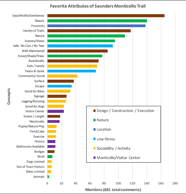
The Thomas Jefferson Foundation has already reached part way toward Charlottesville by creating the Saunders-Monticello Trail. This winding two-mile pathway is fully ADA accessible (while climbing a mountain!) and its beauty attracts tremendously diverse visitors (140,000 annually, per TJ Foundation). It is one of the region’s most successful pieces of landscape architecture and on a nice day, its parking lot is often overflowing. Although just past the edge of town, the trail head can only be reached by car, placing both the trail and Monticello out of reach for many. Completing this connection to Charlottesville would not be as difficult as it may seem. In fact, the trip was quite easy not long ago and it could be again soon.

Monticello Road Extended
Monticello Road is a historic street that begins in downtown Charlottesville and extends south until it is unceremoniously truncated by Interstate 64. Back in 2012, as I was working on my Monticello Road community arts project, I made a startling discovery.

Monticello Road continues, hidden, disused and covered with leaves, on the far side of the Interstate. It passes through a magnificent and highly unusual ecosystem surrounding an oxbow of Moore’s Creek trapped by the highway’s construction. The lost road continues past the UVA Foundation’s historic Blue Ridge Hospital, a stunning site in its own right that will eventually become a key part of the regional land use mix. The byway terminates at Michie Tavern, just yards from the Saunders Trail.

This road can and should be brought back into service as a recreational and ecological pathway that is safe and easily accessible for residents and tourists, young and old, athletic and para-ambulatory. This would create an unbroken pathway from the house and gardens of Monticello via Charlottesville’s Downtown Pedestrian Mall to the the University and beyond. Along the way there are abundant opportunities to discover and interpret a rich diverse historical, cultural and ecological patrimony, and to do so in a way that reflects a spectrum of experience.

The project does have some hurdles besides leaf litter on the historic right-of-way. A tunnel will be required under I-64 and a way to get across the Monticello Parkway. Chris Gensic, Charlottesville’s Trail Coordinator, and a champion of the project, has some innovative ideas that are viable and proven in nearby towns. The project would not be free, but the benefits are so enormous that a compelling plan will certainly mobilize support from citizens, government and the foundation and business communities.

Understanding—and Negotiating—the Past
While advocating for the connection, the project will also make the case that it be done in an inclusive way. My work in the community and at the University has taught me that a place is the sum of its physical characteristics and the lives— human and non-human, past and present—that abide there and they are not always easy to untangle.

This project needs to be seen in the broader context of the area’s complicated settlement patterns and the fraught relationship between Thomas Jefferson, his University and the people of Charlottesville. This interstitial zone, resonant with memories, even physical traces (such as a disused quarry) is an excellent opportunity for multi-voice testimony that reflects its dynamic and on-going story. The stunning and tranquil natural setting is highly amenable to contemplation and learning.

Preparing for the Future
The project will be tremendously beneficial but we know that well-intended projects can have unpleasant or even unjust consequences and we must anticipate and prevent those.

For example, the trailhead will sit between two neighborhoods that are sensitive to change: Belmont, which is historically working-class but is seeing tremendous turnover, and Carlton (also known as Hogwaller), which is one of the area’s most challenged communities. This project will certainly have powerful market effects and we cannot allow an otherwise beneficial project to cost people their homes or businesses.

Similarly, the land the trail will traverse is successful and biologically diverse in large part because it has been inaccessible for such a long time. It is mandatory that it be protected, while being available for its educational and restorative offerings.

My project will look closely at socio-economic and ecological impacts and seek creative urban and environmental strategies to assure that we do not create with one hand and destroy with the other. This is not just about cool infrastructure; it’s about making our community better for everyone.

An Inclusive Approach
That triple bottom line (social, economic and ecological) can only be obtained through a broad and inclusive partnership. On the most basic level, even though the route is short, it touches land controlled by Charlottesville, Albemarle County, the Virginia Department of Transportation, the UVA and Thomas Jefferson Foundations and two private land-owners. It is a three-dimensional web with many layers and very complicated.

Fortunately, I will not have to tackle the project alone. Monticello accessibility is already in the City’s Bicycle and Pedestrian Master Plan as a proposed “arterial trail corridor.” I have been in conversation with the City about this for some time and am currently interning in the responsible department. This is already penciled into their plans.

I’ve learned many things in my hours along Monticello Road and I can say with confidence that the community is strongly behind the project. I have been building a network of citizens, businesses, civic and religious institutions. I have good connections in the Public Schools, community groups related to fitness, ecology, arts and social justice and a verbal commitment from a significant local Arts and Design organization for institutional backing. The participatory aspect will not be lacking.

The most important resource I have, and the reason I am making this proposal now, is that as a Masters Candidate in the University’s Architecture School, I can also bring the University’s considerable resources, knowledge and design expertise to the problem. My Thesis will provide opportunities and the intellectual space to think this project through with all of its implications.

Conclusion
The students of Clark Elementary School, a Title I school, can see the mansion from their classroom windows yet they cannot get there easily. That needs to be corrected. It is not difficult to imagine a walking field trip in which children will learn their nation’s history, while absorbing local social and ecological context, getting fitter and breathing fresh air. They, like the city as a whole, deserve access to this tremendous resource from their doorstep. Not only will it make the city we have better, but it will help orient future opportunities for economic growth and natural escape squarely within the urban ring, the only real solution to sprawl.

This project will bring stakeholders together around a compelling vision to chart a direction for a profoundly beneficial new resource. One of my favorite things about the project is that although it will be new to us, it will follow a route that is very old. Thomas Jefferson, who could see the University from his porch, would have used a very similar path to get there. We must re-open it.

[Printable [pdf] version of this document]

Sunday, May 22, 2016

Moblizing by Moosifying


It was impossible to choose a best photo from this event but Ms Dogwood dunking the ex-mayor was typical. [more]

In case you ever needed another reason to go Moose’s Restaurant (and there were already plenty), they just did a super-cool fundraiser for the Shelter for Help in Emergency.

The fun unfolded in three parts. They kicked off on Friday (the 13th) with a doughnut eating contest. Saturday morning (the 14th) they had a block party that included music, dancing, a craft fair, a race car you could touch (and pose with) and—best of all—a dunk tank that was extremely busy. Saturday night was a concert at the Jefferson School. The fundraiser netted $3050 and lots of fun and community fellowship.

When I first visited Moose’s (then called Moore’s Creek) I was afraid to go inside 1) because they share a building with a gun shop and 2) because there were a million police cars parked outside. That seemed like a bad combination, but come to find out that the cruisers were there because it’s the best short-order restaurant in Charlottesville. They all stop there on their way into town or between shifts.

Wednesday, January 13, 2016

Where are the Pictures?


As part of my coursework in Urban and Environmental Planning at the University of Virginia, I am performing a series of GIS (Geographic Information System) analyses of the Monticello Road project. GIS provides empirical data to check (or underscore) what intuition tells us. This is the second of a three-part meta analysis. Previous: Vanishing Landscapes | To Come: Backer Distribution


I often receive process questions about the project, especially as pertains to what parts of the neighborhood I photograph and I how I define the boundaries of the Monticello Road study area.

I typically answer that I consciously limit the project to the street and directly-adjacent properties and I believe that the images will be distributed throughout the length of the street—though not evenly, perhaps clustered around my home or a few places where I spend sedentary time. These responses are logical but not empirical. GIS analysis lets us answer the question with data.

Through the life of the project, I have captured thousands of images, which would have been overwhelming. One of the features of photography is that it not particularly relevant if an image is made; what matters is which images are seen.

I have a subset of selects (numbering in the low hundreds) that are used in the book and the frequent slideshows I present. That provides a further curation because it reflects both a photographer’s view of what is visually interesting and an editor’s view of what says something about the place. I refined my selection one more time by eliminating multiple images all taken at the same time (different people at the same party, for example). Through this process, I reduced the sample to 94 images, a highly manageable number, but enough for a meaningful analysis of a linear mile-long space.

Monday, December 21, 2015

About that View...


Two photos from the same spot, taken three years apart. Left: "The Park, 2012." Right "Belmont Steps subdivision, 2015."

As part of my coursework in Urban and Environmental Planning at the University of Virginia, I am performing a series of GIS (Geographic Information System) analyses of the Monticello Road project. GIS provides empirical data to check (or underscore) what intuition tells us. This is the first of a three-part meta analysis. Next: Picture Distribution | To Come: Backer Distribution

Although it is not the main purpose, the Monticello Road project provides undeniable (and sometimes wrenching) evidence of the ways the neighborhood changes over time. The above pairing is especially jarring. We know that frequent low-dose exposure to Nature is beneficial to health and well-being. I suspect that the same can be said of Heritage as well so its loss is something we notice.

When one of my colleagues saw the above photo, he was surprised to hear that the Neighborhood Association did not oppose the subdivision. In fact, there was nothing for them to say about it because it was done by-right, meaning the land-owner did not need anyone's permission as long as they stayed within the zoning regulations, which they did. Additionally, we say all the time that we like in-fill development (instead of sprawl) and this is what it looks like.

So although this kind of change is inevitable and possibly beneficial, we should not pretend that there is no cost. We know there is, but it is not quantifiable, which is a real liability when we consider the pocket full of financial statistics a developer will present.

GIS allows quantitative viewshed analysis and I thought it would be interesting to look at the cumulative effect of building upon the the landscape and heritage vistas in the neighborhood.

For reference, I chose the peak of Mont Alto, so beautifully framed in the photo above left.

Wednesday, October 21, 2015

Broaden Public Access to Ragged Mountain


It's essential that we get more people--especially kids--into the woods. It's definitely possible to do so without harm--but it will require some work.
(Story|Line Photo: Preston Jackson)


Here's a brief I emailed to Charlottesville City Council about a proposal to open up the Ragged Mountain Natural Area to runners, cyclists and leashed dogs, which are currently prohibited. Council response follows in the comment section.

I had hoped to write you a proper brief about Ragged Mountain and even testify at the meeting tonight, but I have another commitment and won't be able to make it. I believe that if it will not interfere with drinking water quality, then allowable uses should be expanded. It needs to be a zone of active teaching and it is an opportunity and responsibility that must be shared with Albemarle County.

Key Issues (besides water quality, which I cannot address):

Thursday, September 17, 2015

Yard Dreams


Yard Dreams takes art out of the white box and into the streets—and yards—of Belmont. I will be one of fifteen 15 artists installing art in neighbors’ yards this for the weekend. The art will be on view 5 p.m. Friday to 5 p.m. Sunday, with a self-guided tour all weekend and a fun neighborhood potluck block party to celebrate the end of Summer on Saturday evening (3-9).

My piece, mending, tweaks two of my neighbors via perhaps the best-known poem in the American canon, Robert Frost’s Mending Wall. The two—both my friends—have a long list of grievances and have found that the best solution is not engage with one another at all. Sometimes that is the best idea, and it probably is in this case and a palisade fence now separates them.

Although the best-known phrase in the poem is “Good fences make good neighbors,” Frost clearly thinks otherwise and backs his claim by pointing out that Nature never allows a fence to stand for very long.

My piece, presented with the good-spirited cooperation of one of the neighbors in question, allows visitors to rearrange the words of that line to propose alternative approaches.

Interested in community engagement through the arts? This is what it looks like. Map, info at http://yarddreamspvcc.com/
Daily Progress Preview